Recreation & Tourism

Clear Hills County offers an abundance of recreational opportunities, including camping, boating, fishing, swimming, hunting, skiing and hiking.

There are several campgrounds, lakes, golf courses, halls, arenas, rodeo grounds, etc. throughout the County.  Baseball diamonds are located in Hines Creek, Worsley, Cleardale, Bear Canyon and Whitelaw, and tennis courts can be found in Hines Creek and Cleardale.  There is a OHV Park east of Cleardale. Blue Devil Wilderness Camps offers prearranged wilderness camps year round for various age groups and skill levels. The David Thompson Bible Camp offers summer camps for various age groups.  There are leadership camps that also utilize the David Thompson Bible Camp facility.

Mighty Peace Tourism

Seasonal Activity Guide

Hello and thank you for your interest in our seasonal Activity Guide.
 

Agricultural Societies & Recreation Boards

Organizes activities and disburses funding for various recreational organizations and activities in the  Whitelaw/Deerhill area.

Operates the Cherry Canyon Hall, community library, ball diamonds, indoor curling rink and playground.  It also disburses funding for various recreational organizations and activities in the Bear Canyon/Cherry Point area.

Operates the Clear River Campground, Cleardale Golf Course and is involved with the Cleardale Riders, gymkhana and with the Family Fun Days Rodeo at the Clear River rodeo grounds.  Also disburses funding for various recreational organizations and activities in the Cleardale area.

Operates the David Thompson Hall and grounds

Operates the Eureka River Hall, picnic grounds and a gymkhana site.

Operates the Dave Shaw Memorial Complex.

Disburses funding for various recreational organizations and activities in the Hines Creek area.

Operates the Worsley Arena and facilitates the Worsley Red Cross Swim Program.

Disburses funding for various recreational organizations and activities in the Worsley area.

Campgrounds

25 km west of Hines Creek on highway 685.  Kitchen shelter, water, boat launch ( on the Peace River), fishing, RV station, hiking trails, playground. (780) 494-2222

Located on Highway 64.  Kitchen shelter, water.  (780) 685-2257.

4.5 km south of Hines Creek on highway 64.  15 sites, electrical hook ups, kitchen shelter, water, boat launch (no fishing) horseshoes,  swimming, beach, hiking trails, playground. lake cruise.  (780) 494-3684.

clear-hills-county-george-lake-032-2

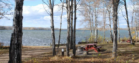
24 km south east of Worsley, off highway 64. Kitchen shelter, water, boat launch (on the Peace River), fishing, playground, hiking trails, horseshoes.  

https://manyislandscampground.ca/


6.5 km south of highway 64 (towards Alberta/B.C. Border).  Water, boat launch, playground, fishing, swimming, hiking trails. (780) 595-2155.

ole

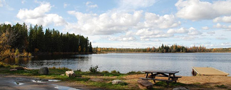
8 km East, 22 km north of Worsley.  Water, boat launch, fishing, swimming, playground, hiking trails. 780-772-1858

Approximately 20 km north of Hines Creek. 20 sites, fire pits, lake, boat launch, fishing, swimming, and hiking trails. 780-772-1858

Approximately 30 km northeast of Hines Creek. 20 sites, lake, fishing, playground. RV dumping station.780-219-0126

Located in Worsley, power sites with RV sani-station near campground.780-686-3835

Located in Worsley, full hookups. 780-835-0448

Cultural Sites

Located at the junction of Hwy 64 and Hwy 685 at the southern of the two exits for the Village of Hines Creek. It is open from mid-May to mid Sept, Monday to Saturday 10:00 to 6:00, Sunday 1:00 to 6:00, last tours at 4:30. “Bringing the homesteading history of Hines Creek to life.” Our museum has three furnished homes, a Lutheran and an Anglican church, a one room school house, historic community hall, NAR caboose, trapper’s cabin, contemporary log building with wildlife and forestry exhibits, an old store, a District Nurse’s examination room and much more. Our staff offer informative and interesting tours and our inviting grounds are the perfect place to picnic. Farmers’ Market Saturdays 10:00 to 1:00, amazing cinnamon buns.

Phone: Curator, Jean Young 780-834-6538 (Wed. to Sat.) or Nancy Van Herk 780-835-7827,
Email: hinescreekmuseum@gmail.com
Website: endofsteelmuseum.weebly.com

Located in Worsley, Alberta. The museum is open most days during the summer months. 780-835-8336

Golf Courses

On Highway 64, 3 miles south of Hines Creek. 9 holes, club rentals, cart rentals, pro shop and camping available. (780) 494-2217

Located on Highway 64., 5.5 km west of Cleardale. 9 holes, sand greens, camping and picnic area.

Historic Sites

All Saints Anglican Church, situated on SW 14-83-13-W6M, was declared a Municipal Historic Resource in 2009.   The Church is the only consecrated building in the community and has been available to everyone for worship services, baptism, weddings and funerals for 80 years. The church was an integral part of an area that is geographically isolated by rivers on all sides and was a social focal point for three communities; Cherry Pont, Bear Canyon and Clayhurst.

The All Saints Anglican Church is one of the oldest extant churches in the county. Anglican missionaries began working in the area in the early 1930s, shortly after the first settles arrived. Local volunteers began constructing the building in and the first service was held in the unfinished building on August 25, 1937. The church was completed over the next year and dedicated the following September.   Since that time, the church has been an important gathering place in a rural community that is geographically isolated by rivers.   The Anglican missionaries, or van workers as they were known, provided Sunday School Caravan Services for the area and once the Church was built stayed in the Mission House throughout the year. In addition to attending to the spiritual needs of the areas residents many of them were capable practical nurses and provided these services as well. For nearly 60 years, local residents attended weekly services here and several generations have celebrated and observed baptisms, conformations, marriages and funerals. During the 1930s, the church was a shining star in the darkness, bringing people together in spite of their differences. All Saints continues to play an important part because it is still available for weddings, baptisms, confirmations and funerals.

The All Saints Anglican Church architecture incorporates gothic revival features such as the pointed arch windows and vaulted sanctuary that is separated from the nave by a railing. The original handmade box for the Chalice and Communion set is still used and the pews are original and hand hewn.

Key elements that define the heritage character of the All Saints Anglican Church.

  • Square timber construction;
  • Nailed frame;
  • Front porch entry
  • Rear wing
  • Bell tower
  • Pointed arched windows
  • Cross on top of bell tower
  • Vaulted sanctuary

Sources:

Recreational Facilities

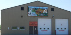
The Complex has a curling rink with 4 sheets of ice, as well as an arena used mainly for hockey and figure skating.  There is also a hall with a full kitchen. (780) 494-3690

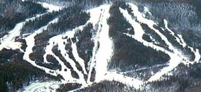
Located 25 km northwest of Worsley. Boasting a new triple chair lift and a t-bar, fully equipped lodge, chalet, rental shop, ski/snowboarding school. 17 different runs. Vertical rise of 460 feet. Well groomed natural snow.  Check out their website www.skiworsley.comor phone them toll-free 1-866-685-2594.

skihill

The arena offers public skating, hockey and curling. (780) 685-3921.

The community centre offers a spacious meeting room with a full kitchen as well.  (780) 685-3925.

fire-hall

If you would like to add your recreation site or community centre/facility please email us.

Peace Valley Snow Riders Trails

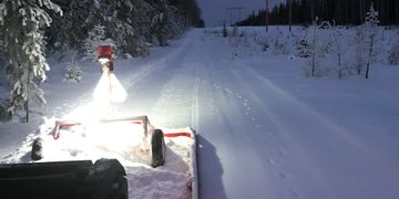
Officially opened March 5, 2016 in conjunction with the Club’s first Poker Rally.  This 30 km trail runs in a loop to the east and north of St. Isidore.  The staging area can be accessed from Township Road 842 north of St. Isidore.

Also access point from Hamlet of St.isidore for people in that area.

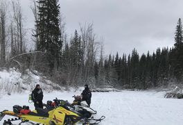
Officially opened March 19, 2011.  Located north of Peace River.  Runs 40 km north from the Leddy Lake Recreation Area to the area of Driftwood Lake near Deadwood. It also crosses the beautiful Whitemud river valley. The trail also includes a small loop near the Leddy Lake Recreation Area.

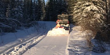
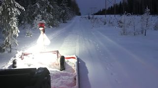
Officially opened March 11, 2017. The East End Staging Area is located to the north of Grimshaw and the West End Staging Area is located to the north of Hines Creek.  Runs 60 kilometers from north of Figure Eight Lake to just east of Stony Lake.  This trail includes a loop near the west end of the trail that has a magnificent view of the area.

Work on this trail was formally initiated in the spring of 2015 and is currently in the final approval process.  Final approval is expected to be in place shortly, hence if funding can be identified this trail could be developed during the winter of 2017/18.  This 50 km trail would link the Smith Mills Trail with the Village of Hines Creek and in doing so, would be the first trail in the area offering sledders direct access to fuel, food, lodging and repair services similar to trails in Eastern Canada.

Will be open for 2018-2019

As one of the original 3 trails identified by the Club and approved in principle in December of 2009 along with the Leddy Lake and Wesley Creek trails, further work has been delayed during the development of the Club’s other trails.  This proposed trail would be an extension to the Wesley Creek Trail and will potentially run north along the power line which is adjacent to the DMI east haul road.  Work could proceed once the Hines Creek Trail is complete if a Trail Sponsor to lead the project is identified.

As part of the long range goal to complete a network of trails on both the east and west sides of the Peace River, there is also commitment to link our local network to those of other member Clubs of the Alberta Snowmobile Association as part of an overall network of trails within the Province of Alberta.  From a conceptual perspective the Club has identified the potential of the following trails becoming part of the local trail network, Dixonville Connector & Talbot Lake Trail.