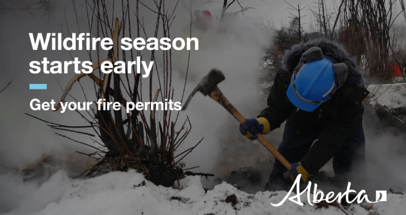
PUBLIC ANNOUNCEMENT – May 25, 2023 10:36 a.m

Alberta portion of G80220 – Boundary Lake/Bear Canyon

PUBLIC ANNOUNCEMENT! May 31, 2023 8:16 a.m.

GWF018 (Cleardale/Peace Riverbanks)

Classified as out of Control.

The weather was in our favor yesterday with minimal wind so the Dozer crews were able to continue to actively secure guards on all sides needed and helicopters were able to access the area and dump where needed. The volunteer Fire departments continued to work on hotspots and protecting any structures in the vicinity.

Currently the east end of the fire is between Range Road 64 and 65 and 3 km South of Highway 64.

Alberta Fire services are anticipating being able to regain a held status by the weekend.

Updates will continue as we receive them.

PUBLIC ANNOUNCEMENT! May 30, 2023 11:12 a.m.

GWF018 (Cleardale/Peace River Banks)

Classified as out of Control

High winds caused the wildfire to gain some traction last night.

Currently the east end of the fire is between Range Road 64 and 65 and 3 km South of Highway 64.

The wind is calm today and the Dozer crews are actively securing additional guards. The volunteer Fire departments continue to work on protecting any structures in the vicinity.

Winds are expected to be minimal today, however stay alert for changes in weather and watch for updates as we receive them.

Updates will continue as we receive them.

PUBLIC ANNOUNCEMENT! May 29, 2023 10:09 p.m.

GWF018 (Cleardale/Peace River Banks)

Classified as out of Control

High winds caused the wildfire to gain some traction tonight. Currently the east end of the fire is still approximately 1km west of Range Road 64 and 3.5 km South of Highway 64.

Large bombers were brought in with fire retardant to assist as well as the helicopter dumps. Alberta fire service ground crews along with the Worsley and Hines Creek Volunteer Fire department worked hard this evening to keep things safe.

The wind has calmed and the Dozer crews can now actively secure additional guards.

Updates will continue as we receive them.

PUBLIC ANNOUNCEMENT! May 29, 2023 6:09 p.m.

GWF018 (Cleardale/Peace River Banks)

Classified as out of Control

High winds have caused the wildfire to gain some traction. Currently the east end of the fire is approximately 1km west of Range Road 64 and 3.5 km South of Highway 64.

Large bombers are being brought in with fire retardant to assist.

At this time we are asking people to avoid traveling on Highway 64 from Range Road 62 to 74.

Updates will continue as we receive them.

PUBLIC ANNOUNCEMENT! May 25, 2023 10:36 a.m.

GWF018 is currently classified as Being Held (BH).

Alberta Fire Services reports the wildfire at 80 per cent contained.

A small section of the fire which was extended towards Hines Creek has been contained by a fire guard.

Crews are continuing to successfully use direct attack on the fire’s east flank and crews are monitoring the fire and continuing to put out hot spots adjacent to a fire guard.

PUBLIC ANNOUNCEMENT – May 21, 2023 9:55 a.m

GWF018 (Cleardale/Peace River Banks)

Classified as Out of Control

Alberta fire services has updated us with following information:

Yesterday had a few flareups amongst the center of the burn area causing additional smoke. Ground and air crews are working on hotspots and guards on the east end.

They are predicting that with the forecasted rain for the next couple days they will be able to gain control.

Fire Services has confirmed that even though the fire is slowly moving the fire has not crossed over to the Montney/Carters Camp area, and they are continuing to monitor the fire activity closely.

PUBLIC ANNOUNCEMENT – May 20, 2023 11:12 a.m

GWF018 (Cleardale/Peace River Banks)

Classified as Out of Control

Alberta fire services has updated us with following information:

Air and ground crew are hoping that with less smoke today they will be able to start working on guards on the east end again. Ground crews continue to watch for new hot spots where and when it is safe.

Fire Services has confirmed that the fire has not crossed over to the Carters Camp area, and will continue to monitor through the weekend.

PUBLIC ANNOUNCEMENT – May 19, 2023 12:20 p.m.

GWF0018 – Peace Riverbanks/Cleardale

classified as out of control. – It is estimated to be 48,000 ha in size

Heavy smoke in the area has made for another difficult day to get accurate reports, however air and ground crews are able to work on the west end of the fire as it is less smoky in that area.

The east end is sitting quieter at the moment as there is very little wind. Forecasts are calling for a slight southwest wind this afternoon so we might see a small amount of movement towards late afternoon evening. We will continue to update you as we know more.

We will continue to update you as we know more.

PWF046 (Cleardale)

Being held (BH): given current weather conditions and resources, the wildfire is not anticipated to grow past expected boundaries.

This fire is located on the northeast side of Cleardale just north of Highway 64. Air and ground crews actively worked last night to contain this fire. They will continue to monitor the area.

PUBLIC ANNOUNCEMENT – May 19, 2023 11:18 a.m.

G80220 – Boundary Lake/Bear Canyon

Thanks to all the volunteers and fire crews the wildfire has been moved to Being held (BH): given current weather conditions and resources, the wildfire is not anticipated to grow past expected boundaries. B.C. Fire Services will have a crew monitoring the area for a few more days. Drone scanning has begun in the evenings to pick out any areas of concern.

PUBLIC ANNOUNCEMENT May 18, 2023 8:30 p.m.

PWF046 (Cleardale) NEW!

Fire started this evening on the northeast side of Cleardale just north of Highway 64. Air and ground crews actively worked on this fire to extinguish it. They will continue to monitor the area.

GWF018 (Cleardale/Peace Riverbanks) May 18, 2023, 9:10 a.m.

Status: Classified as Out of Control – Approximately 48,000 Hectors

This morning, heavy smoke has hindered the air crews’ ability to provide visual reports to Alberta Fire Services.

On the east end of the fire, there was limited movement south of Highway 64 within the vicinity of Range Road 70-65 and Township Road 844. A few flare-ups occurred around Range Road 73; however, ground crews and air crews effectively managed to control them.

Yesterday, shortly after 7:00 p.m., a minor flare-up was observed on the south side at the intersection of Highway 64 and Secondary Highway 726 (Worsley). Prompt action by the crews resulted in its swift extinguishment.

Today’s wind forecast indicates it should be blowing from the southeast, which is expected to work in our favor. This wind pattern will drive the wildfire away from the Carters Camp and Montney River area and cause it to blow back into itself.

It is not uncommon to observe flare-ups within the fire-guarded and previously burnt areas. These locations are under close monitoring, and we appreciate the vigilant reporting from the public when such sightings occur.

Highway 64 has been reopened. However, we urge drivers to exercise caution as the smoke may cause reduced visibility, and crews are actively working in the area.

ATCO is presently engaged in repairing damages and restoring power to affected residents.

We will continue to provide further updates as soon as they become available.

WF018 (Cleardale/Peace Riverbanks) May 17, 2023, 6:10 p.m.

Classified as Out of Control

Update from Alberta Fire Services

The southwest end of the fire has had a little growth along the riverbank today however Ground Crews were not able to complete the planned guard down to the river south of Cleardale today due to conditions, and will attempt to complete it tomorrow.

The east end of the fire had some movement south of Highway 64 in the areas of Range Road 70 – 65 and Township Road 844. Air crews were steady all day and the Ground crews were actively working on securing guards in that area.

The area around Many Islands had a few hotspots throughout the day but crews were able to extinguish them.

Alberta Fire service reported that there is still no active fires in the Carters Camp area as of this afternoon, and is monitoring the areas frequently .

It is common to see flare ups in amongst the fire guarded areas, these areas are being monitored closely. We nonetheless still very much appreciate the calls that come in when spotted!

Highway 64 is now reopened, please drive careful as smoke may cause low visibility and crews are still out and about working along the area.

ATCO is out and working hard to repair and restore damages and lost power to the residents.

More updates will be provided as we receive them.

GWF018 (Cleardale/Peace Riverbanks) May 17, 2023, 9:00 a.m.

Classified as Out of Control

Update from Alberta Fire Services

The southwest end of the fire has had some small growth along the riverbank Ground Crews will be going in to create a fire guard along the existing trail that leads down to the river south of Cleardale.

The east end of the fire had some slight movement south of Highway 64 in the area of Range Road 70 and Township Road 844 with a small move towards the Montney River. Ground crews will be actively working today on securing guards in that area.

The area around Many Islands had a few hotspots overnight but crews were able to extinguish them.

It is common to see flare ups in amongst the fire guarded areas, these areas are being monitored closely. We nonetheless still very much appreciate the calls that come in when spotted!

Highway 64 is now reopened, please drive careful as smoke may cause low visibility and crews are still out and about working along the area.

ATCO is out and working hard to repair and restore damages and lost power to the residents.

More updates will be provided as we receive them.

PUBLIC ANNOUNCEMENT-May 17 2023 9:10 a.m.

PWF034 (Clear Prairie) is currently classified as Being Held (BH).

The wildfire seen some small flare ups around the fire guards last night. Ground Crews actively worked to control the flareups.

It is common to see flare ups in amongst the fire guarded areas, these areas will be closely monitored for any additional activity. We nonetheless still very much appreciate the calls that come in when spotted!

PUBLIC ANNOUNCEMENT – May 13, 2023 5:35 p.m.

ALERT: PREPARE TO EVACUATE

GWF018 (Cleardale/Peace River Banks)

Classified as Out of Control

Clear Hills County has issued an emergency alert as a precautionary measure for the residents in the area south of Township Road 854 to Highway 64 from Range Road 84 east to Range Road 74.

All residents in the impacted area must prepare to evacuate on 1-hour notice. Gather pets, important documents and medication, and enough food, water, and supplies for at lease 72 hours.

Impacted residents may evacuate to Worsley Gateway Inn. If you need help evacuating, call 780-835-8097.

An Alberta Emergency Alert will be issued if an evacuation order is required. Stay tuned to local media and follow directions of authorities.

GWF018 (Cleardale/Peace River Banks) May 13, 2023 10:09 a.m.

Classified as Out of Control

Alberta Fire Service crews worked well into the evening on the active wildfire. The fire reached Highway 64 in just a few places; fire crews were able to extinguish the areas as they crossed over to the south side of Highway 64.

Crews will start to cut guard on the northeast side of Many Islands as a safety precaution continue to tight line the area to the west to gain more control. Secondary guards are being placed where needed. Helicopters and bombers will be active throughout the day. They are foreseeing that it will continue to move north towards highway 64 between the area of Range Road 84 and the intersection of secondary highway 726 (Worsley).

The west side of the fire has presented to be less of a priority at this time as it has run itself into cultivated fields and will be easier to maintain at this time.

Heavy smoke is present causing poor visibility in areas.

At this time, we are asking any one within the area of Range Road 74 north to Township 854 west to Range Road 84 and south to Highway 64 to be alert and prepare to evacuate on a 1-hour notice.

Fire crews are working hard to prevent the fire from moving, however conditions are unpredictable.

Effective immediately Highway 64 from the intersection of 726 (Worsley) to Cleardale will be closed. The detour has been set up at Range Road 74 around Township 854 and south on Range Road 84. (Follow detour signs)

An Alberta Emergency Alert will be issued if an evacuation order is required. Stay tuned to local media and follow the directions of the authorities.

PUBLIC ANNOUNCEMENT – May 13, 2023 10:35 a.m.

G80220 – Boundary Lake/Bear Canyon –

The wildfire is approx. 1,300 hectors on the Alberta side. BC Fire service has a full fire guard is currently in place. The southeast corner may see some more increased action this afternoon as fire crews work to burn off some areas within the fire guard. Increased smoke will be present and make for poor visibility.

They currently have an active ground crew as well as a helicopter working on this fire.

BC Fire services are still anticipating that they should have the Alberta portion of the fire in a Held status by Sunday.

Drone scanning will then begin in the evenings to pick out areas of concern.

updates will be posted as we receive them.

PUBLIC ANNOUNCEMENT -May 12, 10:13 p.m.

IMPORTANT: EVACUATION ALERT!!

GWF018 (Cleardale/Peace River Banks)

Currently classified as Out of Control

An evacuation alert has been expanded as we move into the evening for the area of Highway 64 North on Range Road 74 to Township Road 854 West to Range Road 84 than back South to HWY 64.

All residents in the impacted area must prepare to evacuate on a 1 hour notice.

Prepare to evacuate. gather pets, important documents and medication, and enough food, water and supplies for at least 72 hours.

An Alberta Emergency Alert will be issued if an evacuation order is required. Stay tuned to local media and follow the directions of the authorities.

The link below will take you to the Emergency Alert issued and contains an area map of the newly expanded area.

https://www.alberta.ca/aea/cap/2023/05/12/2023-05-12T22_09_05-06_00=ClearHillsCounty=AF5D6997-DD4B-4E23-A6B7-6C794D9E5C73.htm?fbclid=IwAR3yfOklA89H8Akwh5UXMbbgOcI3otgxjpFuo5IugPg-3rcHqYIEfTR0PL4

PUBLIC ANNOUNCEMENT -May 12, 2023 8:50 p.m.

IMPORTANT: MANDATORY EVACUATION ALERT!!

GWF018 (Cleardale/Peace River Banks)

is currently classified as Out of Control

Currently the wildfire has reached highway 64, west about halfway between Highway 726 intersection and Range Road 84. Crews were able to put the fire out when it jumped the highway. Highway 64 is acting as a natural fire guard and crews have cultivated the ditches and prepared the areas north of the highway.

A fire guard has been placed on the southwest side of highway 726 towards the peace river.

Additional groundcrews as well as multiple air crews are working nonstop.

Immediate evacuation is in order for the area from the intersection of highway 64/highway 726 (Worsley) north to Township Road 854, from Township Road 854 to Range Road 84 then back south to Highway 64.

Pack clothes, food, water, important documents, and medication for 3 days. Bring your pets.

Accommodations & meals can be found at the Worsley Gateway Inn. Please contact Clear Hills County as soon as you are evacuated to safety 780-835-8097.

Effective immediately Highway 64 from the intersection of 726 (Worsley) to Cleardale will be closed. The detour has been set up at Range Road 74 around Township 854 and south on Range Road 84.

More updates to come as we receive them.

GWF018 (Cleardale/Peace River Banks) May 12. 2023 9:16 a.m.

Classified as Out of Control

Alberta Fire Service has ground crews cutting guard and working on tight lining the area to gain more control. Secondary guards are being placed where needed. Helicopters and bombers will be active throughout the day. They are foreseeing that it will continue to move north towards highway 64 along the area of Range Road 84. Heavy smoke is present causing poor visibility in areas.

Fire crews are working hard to prevent the fire from moving, however conditions are unpredictable. At this time, we are asking any one in that area to be alert.

Preparations are in place to close highway 64 from the intersection of secondary highway 726 (Worsley) to Cleardale if it becomes a threat.

It is important that the public stay away from the surrounding area for their safety, as well as to allow for Alberta Fire Services to continue to work diligently to secure and control the fire.

We will continue to provide an update, along with an updated map of this active wildfire as we receive them.

PUBLIC ANNOUNCEMENT – May 12, 2023 9:05 a.m.

G80220 – Boundary Lake/Bear Canyon –

The wildfire is approx. 1,300 hectors on the Alberta side. BC Fire service has a full fire guard is currently in place. The southeast corner may see some increased action this afternoon as fire crews work to burn off some areas within the fire guard.

They currently have an active ground crew as well as a helicopter working on this fire.

BC Fire services are anticipating that they should have the Alberta portion of the fire in a Held status by Sunday. Drone scanning will then begin in the evenings to pick out areas of concern.

updates will be posted as we receive them.

PUBLIC ANNOUNCEMENT -May 11, 8:35 p.m.

IMPORTANT!

GWF018 (Cleardale/Peace River Banks)
is currently classified as Out of Control

Alberta Fire Service has advised to be alert as the wildfire has crossed the guard on the north east side flaring. They are anticipating that it will be moving north towards highway 64 moving along approximately Range Road 84.

At this time we are asking any one in that area to be alert.

Preparation are in place to potentially close highway 64 from the intersection of secondary highway 726 (Worsley) to Cleardale if it it becomes a threat.

Fire crews are working hard to prevent the fire from moving, however conditions are unpredictable.

We will continue to provide an update as we know more.

PUBLIC ANNOUNCEMENT – May 11, 2023 2:40 p.m.

GWF0018 – Peace Riverbanks/Cleardale – estimated to be 10,508 ha

Alberta Fire Service update

Excessive Flaring and smoke will be visible on the East end of the fire later this afternoon as crews work on backburning. Additional groundcrews, cats and air crews have been assigned and will be actively working with the already placed crews.

Yesterday late afternoons concentrated efforts helped any further advancement, and crews are working to get it secured as soon as possible, as temperatures are expected to reach highs of 31 degrees this weekend with little to no humidity is expected.

Fire Crews made great progress on containing the west end bringing it to approximately 90% held. Ground crews are actively working and monitoring for hotspots and Fields to the north are still being tilled to help to control any movement towards more populated areas.

It is important to stay alert and away from the area for your safety and to allow crews to work.

Alberta Fire Service will keep us updated on the activity.

PUBLIC ANNOUNCEMENT – May 11, 2023 10:25 a.m.

G80220 – Boundary Lake/Bear Canyon –

The wildfire is approx. 1,300 hectors on the Alberta side. The southeast corner did see some increased action yesterday, hindering their plan to backburn on the southeast corner, however their crews were able to halt any further advance using a groundcrew along with 1 helicopter.

BC Fire services are anticipating that they should have the Alberta portion of the fire in a Held status by Sunday.

Drone scanning will then begin in the evenings to pick out areas of concern.

PUBLIC ANNOUNCEMENT – May 10 7:45 p.m.

Alberta Fire Service has updated us with the following information:

GWF0018 (Peace River bank/Cleardale) approximately 10,508 ha in size

The East side of the fire seen increased activity this afternoon, however concentrated efforts by wildland firefighters assisted by helicopters halted its further advance.

It is important to stay alert and away from the area for your safety and to allow crews to work.

Alberta Fire Service will keep us updated on the activity.

PUBLIC ANNOUNCEMENT – May 10 2:52 p.m.

Alberta Fire Service has updated us with the following information:

GWF0018 (Peace River bank/Cleardale)

The East side of the fire is currently seeing more activity with increased flaring, these fire activities are normal for these types of wildfires however additional Crews/resource (helicopters/bombers) have been called in to assist.

It is important to stay alert and away from the area for your safety and to allow crews to work.

Alberta Fire Service will keep us updated on the activity as the day goes on.

PUBLIC ANNOUNCEMENT – May 10, 2023 12:49 p.m.

GWF0018 (Peace River bank/Cleardale) Fire Crews made great progress on containing the west end yesterday bringing it to approximately 90% held. Ground crews are actively working and Fields to the north are still being tilled to help to control any movement towards more populated areas.

Alberta Fire Service have labelled the East side high priority bringing in additional equipment to assist. 2 helicopters, 12-person ground crew as well as 2 dozer crews have been placed and active, water bombers have been requested, however the heavy smoke makes it so they can not access the fire at this time.

East End Wildfires:

The fires on the east end of the county are being monitored daily and considered HELD (contained within their fire guard boundary) , Alberta Fire Service flies the areas throughout the day and will report any new activity.

G80220 – Boundary Lake/Bear Canyon – the wildfire is approx. 1,300 hectors on the Alberta side. BC Fire service is working on backburning the southeast corner hoping to get it completed before the hot weather gets here. BC Fire services will be starting to do drone scanning in the evenings to pick out areas of concern (See map of affected area in Alberta

Please refer to the map for location of the following updates:

G80220 – Boundary Lake/Bear Canyon

Out of control – BC Forestry has taken control of the Alberta portion of this fire (take caution if traveling on Highway 64 towards BC Border smoke is making for poor visibility)

The wildfire is approx. 1,300 hectors on the Alberta side. BC Fire service is working on backburning the southeast corner hoping to get it completed before the hot weather gets here. BC Fire services will be starting to do drone scanning in the evenings to pick out areas of concern (See map of affected area in Alberta

PW0034 – Clear Prairie

Has been 99% held, and crews continue to work on full containment – guards have been placed and fire is secured in the boundaries under the current conditions.

GWF0018 – Peace Riverbanks/Cleardale

Fire Crews made great progress on containing the west end yesterday bringing it to approximately 90% held. Ground crews are actively working and Fields to the north are still being tilled to help to control any movement towards more populated areas.

Alberta Fire Service have labelled the East side high priority bringing in additional equipment to assist. 2 helicopters, 12-person ground crew as well as 2 dozer crews have been placed and are currently active, water bombers have been requested, however the heavy smoke makes it so they can not access the fire at this time.

PW0036 – Eureka River

Currently being held – on watch

PW004 – Montagneuse Valley

Currently being held – on watch, Fire Guard around

PW0037 – Deer Hill

Currently being held – on watch

PW0033- Deer Hill

Currently being held – on watch

PW003- Gage area North of Fairview (NPRL)

Currently being held – on watch, Fire Guard around (Fairview jurisdiction)

PW002-Whitelaw

Currently being held – on watch – (Fairview jurisdiction)

PW027-Whitelaw

Old winter Fire – Under control

Please note the red outlined areas on the map are all still considered active wildfires. These areas are dangerous, you are asked to stay alert and be prepared.

If there is a threat of fire in your area:

⚠️listen for updates from authorities

⚠️be prepared to evacuate at a moment’s notice

⚠️have your vehicle stocked with supplies and ready to go

Fire crews are working diligently to keep you safe.

DO NOT attempt to fight these wildfires by yourself as they are dangerous if you see a new fire please CALL 310-FIRE (3473).

For information on the status of the Village of Hines Creek please contact the Village office @ 780-494-3690

PUBLIC ANNOUNCEMENT – May 9, 2023 10:55 a.m.

GWF0018 (Peace River bank/Cleardale) The lower overnight temperatures and humidity has helped to slow the west end of the fire, Fire Crews made great progress on containing the west end yesterday bringing it to approximately 90% held. Fields to the north are still being tilled to help to control any movement towards more populated areas.

Fire Crews are working on the East side of the fire and Alberta Fire Services brought over additional equipment to assist. So far, the wildfire is staying within the east guard, water bombers have been requested, however the heavy smoke makes it so they can not access the fire at this time. Helicopters with water dumps are continuing to be used as they are able to access the areas needed.

East End Wildfires:

The fires on the east end of the county are being monitored daily and considered HELD (contained within their fire guard boundary) , Alberta Fire Service flies the areas throughout the day and will report any new activity.

G80220 – Boundary Lake/Bear Canyon – An update on the Boundary Lake/Bear Canyon wildfire will come later this morning.

Please refer to the map for location of the following updates:

G80220 – Boundary Lake/Bear Canyon

Out of control – BC Forestry has taken control of the Alberta portion of this fire (take caution if traveling on Highway 64 towards BC Border smoke is making for poor visibility)

PW0034 – Clear Prairie

Has been 99% held, and crews continue to wok on full containment – guards have been placed

GWF0018 – Peace Riverbanks/Cleardale

Considered out of Control, the lower overnight temperatures and humidity has helped to slow the west end of the fire, Fire Crews made great progress on containing the west end yesterday bringing it to approximately 90% held. Fields to the north are still being tilled to help to control any movement towards more populated areas.

Fire Crews are working on the East side of the fire and Alberta Fire Services brought over additional equipment to assist. So far, the wildfire is staying within the east guard, water bombers have been requested, however the heavy smoke makes it so they can not access the fire at this time. Helicopters with water dumps are continuing to be used as they are able to access the areas needed.

PW0036 – Eureka River

Currently being held – on watch

PW004 – Montagneuse Valley

Currently being held – on watch, Fire Guard around

PW0037 – Deer Hill

Currently being held – on watch

PW0033- Deer Hill

Currently being held – on watch

PW003- Gage area North of Fairview (NPRL)

Currently being held – on watch, Fire Guard around (Fairview jurisdiction)

PW002-Whitelaw

Currently being held – on watch – (Fairview jurisdiction)

PW027-Whitelaw

Old winter Fire – Under control

Please note the red outlined areas on the map are all still considered active wildfires. These areas are dangerous, you are asked to stay alert and be prepared.

If there is a threat of fire in your area:

⚠️listen for updates from authorities

⚠️be prepared to evacuate at a moment’s notice

⚠️have your vehicle stocked with supplies and ready to go

Fire crews are working diligently to keep you safe.

DO NOT attempt to fight these wildfires by yourself as they are dangerous if you see a new fire please CALL 310-FIRE (3473).

For information on the status of the Village of Hines Creek please contact the Village office @ 780-494-3690

PUBLIC ANNOUNCEMENT – May 8, 2023 4:45 p.m.

Alberta Fire Services has updated us on the following:

GWF0018 (Peace River bank/Cleardale) The recent overnight humidity has helped to slow the west end of the fire making it easier to keep from growing. Fields to the north are still being tilled to help to control any movement towards more populated areas.

Fire Crews are working on the East side of the fire and Alberta Fire Services has requested an air bomber be brought in to assist with keeping them safe while doing so.

G80220 – Boundary Lake/Bear Canyon – Still waiting on an update from BC Forestry, we will update as soon as we have it.

  • We will continue to update our social media and website as we receive the updates. Thank you for your patience and understanding.

Please refer to the map for location of the following updates:

G80220 – Boundary Lake/Bear Canyon

Out of control – 90 % Held BC Forestry has sent in a team to assist with the Alberta portion of the wildfire. (take caution if traveling on Highway 64 towards BC Border smoke is making for poor visibility)

PW0034 – Clear Prairie

Has been 99% contained, guards have been placed, 4-6mm of rain occurred throughout the night assisting with the active fire.

GWF0018 – Peace Riverbanks/Cleardale

Considered out of Control, fire guards are being put in place. The recent overnight humidity has helped to slow the west end of the fire making it easier to keep from growing. Fields to the north are still being tilled to help to control any movement towards more populated areas.

Fire Crews are working on the East side of the fire and Alberta Fire Services has requested an air bomber be brought in to assist with keeping them safe while doing so.

PW0036 – Eureka River

Currently being held – on watch

PW004 – Montagneuse Valley

Currently being held – on watch, Fire Guard around

PW0037 – Deer Hill

Currently being held – on watch

PW0033- Deer Hill

Currently being held – on watch

PW003- North of Fairview (NPRL) area

Currently being held – on watch, Fire Guard around (Fairview jurisdiction)

PW002-Whitelaw

Currently being held – on watch – Took over by Fairview crews

PW027-Whitelaw

Old winter Fire – Under control

Please note the red outlined areas on the map are active wildfires. These areas are dangerous, you are asked to stay alert and be prepared.

If there is a threat of fire in your area:

⚠️listen for updates from authorities

⚠️be prepared to evacuate at a moment’s notice

⚠️have your vehicle stocked with supplies and ready to go

Fire crews are working diligently to keep you safe.

DO NOT attempt to fight these wildfires by yourself as they are dangerous if you see a new fire please CALL 310-FIRE (3473).

For information on the status of the Village of Hines Creek please contact the Village office @ 780-494-3690

PUBLIC ANNOUNCEMENT – May 8, 2023 2:58 p.m.

Alberta Fire Services has updated us on the following:

GWF0018 (Peace River bank/Cleardale) The recent overnight humidity has helped to slow the west end of the fire making it easier to keep from growing. Fields to the north are still being tilled to help to control any movement towards more populated areas. We are still waiting on an update for the east side of this fire and hope to have that to you soon.

G80220 – Boundary Lake/Bear Canyon – Still waiting on an update from BC Forestry, we will update as soon as we have it.

⚠️We will continue to update our social media and website as we receive the updates. Thank you for your patience and understanding.

Please refer to the map for location of the following updates:

G80220 – Boundary Lake/Bear Canyon
Out of control – 90 % Held BC Forestry has sent in a team to assist with the Alberta portion of the wildfire. (take caution if traveling on Highway 64 towards BC Border smoke is making for poor visibility)

PW0034 – Clear Prairie
Has been 99% contained, guards have been placed, 4-6mm of rain occurred throughout the night assisting with the active fire.

GWF0018 – Peace Riverbanks/Cleardale
Considered out of Control, fire guards are being put in place. The recent overnight humidity has helped to slow the west end of the fire making it easier to keep from growing. Fields to the north are still being tilled to help to control any movement towards more populated areas.

PW0036 – Eureka River
Currently being held – on watch

PW004 – Montagneuse Valley
Currently being held – on watch, Fire Guard around

PW0037 – Deer Hill
Currently being held – on watch

PW0033- Deer Hill
Currently being held – on watch

PW003- North of Fairview (NPRL) area
Currently being held – on watch, Fire Guard around (Fairview jurisdiction)

PW002-Whitelaw
Currently being held – on watch – Took over by Fairview crews

PW027-Whitelaw
Old winter Fire – Under control

Please note the red outlined areas on the map are active wildfires. These areas are dangerous, you are asked to stay alert and be prepared.

If there is a threat of fire in your area:
⚠️ listen for updates from authorities
⚠️be prepared to evacuate at a moment’s notice
⚠️have your vehicle stocked with supplies and ready to go

Fire crews are working diligently to keep you safe.

DO NOT attempt to fight these wildfires by yourself as they are dangerous if you see a new fire please CALL 310-FIRE (3473).

For information on the status of the Village of Hines Creek please contact the Village office @ 780-494-3690

PUBLIC ANNOUNCEMENT – MAY 8, 2023 2:34 p.m.

ATTENTION – Clear Hills County residents:

This important message is on behalf of Clear Hills County and ATCO Electric

There are widespread power outages in the County. Crews are assessing the damages and assigning priorities. ATCO would like to caution residents to stay clear of any downed power lines, and/or crews working in the area. They will work to restore power as soon as possible.

Downed power lines can be extremely dangerous. Contacting an energized line can seriously injure or kill you. If you see a downed power line, please stay at least 10 meters away, call our Emergency outage line 1-800-668-5506 and keep everyone safe from the area.

For updated information on the power outages please refer to https://poweroutage.atco.com/map or download the ATCO app “My ATCO Electricity”.

For more safety tips to stay safe around power lines, visit https://electric.atco.com/en-ca/safety/powerline-safety.html

PUBLIC ANNOUNCEMENT – May 7, 2023 9:59 p.m.

G80220 (Boundary Lake/Bear Canyon) BC Forestry will be sending in a team to assist with the Alberta portion of the wildfire.

GWF0018 (Peace Riverbank/Cleardale) the wildfire Fire Crews made progress on keeping the wildfire held today. Fire crews are actively preparing new guards on the east side of the fire. Fields to the north are being tilled to help to control any movement towards more populated areas.

Please refer to the map for location of the following updates:

G80220 – Boundary Lake/Bear Canyon

Out of control – 90 % Held (take caution if traveling on

Highway 64 towards BC Border smoke is making for poor visibility)

PW0034 – Clear Prairie

Has been 99% contained, guards have been placed, still actively monitoring.

GWF0018 – Peace Riverbanks/Cleardale

Considered out of Control, fire guards are currently being cut along the

east side.

PW0036 – Eureka River

Currently being held – on watch

PW004 – Montagneuse Valley

Currently being held – on watch, Fire Guard around

PW0037 – Deer Hill

Currently being held – on watch

PW0033- Deer Hill

Currently being held – on watch

PW003- North of Fairview (NPRL) area

Currently being held – on watch, Fire Guard around (Fairview jurisdiction)

PW002-Whitelaw

Currently being held – on watch – Took over by Fairview crews

PW027-Whitelaw

Old winter Fire – Under control

Please note the red outlined areas on the map are active wildfires. These areas are dangerous with winds expected to increase, you are asked to stay alert and be prepared.

If there is a threat of fire in your area:

listen for updates from authorities

be prepared to evacuate at a moment’s notice

have your vehicle stocked with supplies and ready to go

Fire crews are working diligently to keep you safe.

DO NOT attempt to fight these wildfires as they are dangerous if you see a

new fire please CALL 310-FIRE (3473).

For information on the status of the Village of Hines Creek please contact the Village office @ 780-494-3690

PUBLIC ANNOUNCEMENT – May 7, 2023 11:25 a.m.

Alberta Fire Services has provided an update on the current wildfire GWF0018 (Peace River Bank/Cleardale) the wildfire has jumped both east & west guards overnight due to wind shifts. The active fire area has grown in both east & west directions.

Fire crews are actively preparing new guards in both directions. Fields to the north are being tilled to help to control any movement towards more populated areas.

updates will come throughout the day on the status of this fire.

An update on wildfire G80220 (Boundary Lake/Bear Canyon) will come shortly.

Please refer to the map for location of the following updates:

G80220 – Boundary Lake/Bear Canyon

Out of control – Currently No Resources (take caution if traveling on

Highway 64 towards BC Border smoke is making for poor visibility)

PW0034 – Clear Prairie

Has been 99% contained it is still considered out of Control, guards have been placed

GWF0018 – Peace Riverbanks/Cleardale

Considered out of Control, fire guards are currently being cut along the

east & west side as well as down to the Peace River.

PW0036 – Eureka River

Currently being held – on watch

PW004 – Montagneuse Valley

Currently being held – on watch, Fire Guard around

PW0037 – Deer Hill

Currently being held – on watch

PW0033- Deer Hill

Currently being held – on watch

PW003- Gage area (NPRL)

Currently being held – on watch, Fire Guard around

PW002-Whitelaw

Currently being held – on watch – Took over by Fairview crews

PW027-Whitelaw

Old winter Fire – Under control

Please note the red outlined areas on the map are active wildfires. These areas are dangerous with winds expected to increase, you are asked to stay alert and be prepared.

If there is a threat of fire in your area:

⚠️listen for updates from authorities

⚠️be prepared to evacuate at a moment’s notice

⚠️have your vehicle stocked with supplies and ready to go

Fire crews are working diligently to keep you safe.

DO NOT attempt to fight these wildfires as they are dangerous if you see a

new fire please CALL 310-FIRE (3473).

For information on the status of the Village of Hines Creek please contact the Village office @ 780-494-3690

PUBLIC ANNOUNCEMENT – Sunday, May 7, 2023 8:59 a.m.

Alberta Fire services are currently flying and investigating all active fires in Clear Hills County. An update is expected by 11:00 a.m. today Sunday, May 7, 2023.

At that time, we will update our website and social media pages.

Please remember that even though the fires that are on the east side of the County are considered HELD they are still active and dangerous.

Fires on the west side of the County with the exception of the Clear Prairie Wildfire (Held) are out of control and extremely dangerous.

Residents of Clear Hills County are asked to stay alert and prepared.

If there is a threat of fire in your area:

⚠️listen for updates from authorities

⚠️be prepared to evacuate at a moment’s notice

⚠️have your vehicle stocked with supplies and ready to go

Fire crews are working diligently to keep you safe.

DO NOT attempt to fight these wildfires as they are dangerous if you see a new fire please CALL 310-FIRE (3473).

Wildfire Numbers:

G80220 – Boundary Lake Area

Out of control

PW0034 – Clear Prairie

Has been 99% contained it is still considered out of Control

GWF0018 – Peace River banks/Cleardale

Considered out of Control, a fire guard is currently being cut along the east side down to the Peace River. It is currently ½ mile south of HWY 64

PW0036 – Eureka River

Currently being held – on watch

PW004 – Montagneuse Valley

Currently being held – on watch

PW0037 – Deer Hill

Currently being held – on watch

PW0033- Deer Hill

Currently being held – on watch

PW003- Gage area (NPRL)

Considered out of Control, Fire Guard around

PW002-Whitelaw

Currently being held – on watch

May 6, 2023 5:10 p.m.

Village of Hines Creek Truck Bulk Water Station will be temporarily closed
effective immediately.  This is being done to allow the water plant to create capacity in the clear well. 

Clear Hills County has the following Non-Potable Truck Fills if needed.

Royce -SE 11-83-06-W6M

Whitelaw- SW 12-84-02-WM      

Eureka River- SW 17-86-05-W6M   

Updated wildfire map for Clear Hills County

Please refer to the map for location of the following updates:

G80220 – Boundary Lake Area

Out of control – Currently No Resources (take caution if traveling on
Highway 64 towards BC Border smoke is making for poor visibility)

PW0034 – Clear Prairie

Has been 99% contained it is still considered out of Control, dozers are on
the SE flanks to make guards.

GWF0018 – Peace Riverbanks/Cleardale

Considered out of Control, a fire guard is currently being cut along the
east side down to the Peace River. It is currently ½ mile south of HWY 64

PW0036 – Eureka River

Currently being held – on watch

PW004 – Montagneuse Valley

Currently being held – on watch, Fire Guard around

PW0037 – Deer Hill

Currently being held – on watch

PW0033- Deer Hill

Currently being held – on watch

PW003- Gage area (NPRL)

Currently being held – on watch, Fire Guard around

PW002-Whitelaw

Currently being held – on watch – Took over by Fairview crews

PW027-Whitelaw

Old winter Fire – Under control

Please note the red outlined areas on the map are still considered out of
control areas and or dangerous. These areas are dangerous with winds expected
to increase throughout the day, you are asked to stay alert and be prepared.

If there is a threat of fire in your area:

⚠️listen for updates from
authorities

⚠️be prepared to evacuate at
a moment’s notice

⚠️have your vehicle stocked
with supplies and ready to go

Fire crews are working diligently to keep you safe.

DO NOT attempt to fight these wildfires as they are dangerous if you see a
new fire please CALL 310-FIRE (3473).

For information on the status of the Village of Hines Creek please contact the Village office @ 780-494-3690

To access the Alberta Wildfire status map click on the link below

https://www.arcgis.com/…/3ffcc2d0ef3e4e0999b0cf8b636defa3

Categories